I was looking for some satellite images recently and I came across a site maintained by NASA called
Visible Earth. It contains thousands of images taken of the earth from various satellites. There were a few images that I found particularly striking, so I thought I would share them with you. I was looking for images of deforestation because I have been reading the book
Collapse: How Societies Choose to Fail or Succeed by Jared Diamond, and it deals heavily with the effects of deforestation on societies (you can read
my review of the book on my personal blog, if you are interested).
One of the hard things about deforestation, and climate change in general, is that many parts of the earth have already been impacted so we don't have a good idea of what the earth looked like before human impact so we can't get a clear picture of the extent to which we have changed the environment. Satellite imagery is only helpful up to a point because we only have a few years worth of data and that can't tell us much about the past, so it is hard to predict how much our actions will affect the climate in the future, and how much needs to be done to preserve our environment. But in some cases areas of the world have been preserved because of the actions of certain governments and thus provide us with a "control group" to show us how much we have already imacted the environment.
Here is one image of northern Argentina and southern Brazil with Paraguay on the top left and Uruguay on the bottom right. [You can find higher resolution images
here.]
The country borders are shown as very thin black lines, but if you notice the dark green "boot" shaped thing in the middle, that is the provice of Misiones in Argentina. A significant protion of that provice is designated as "preserve" and even the parts that aren't are still preserved for specialty logging. The dark green tail coming off the end of the boot is a national park in Bazil.
Another view taken at a different time gives an even starker view of the extent of the deforestation. [Hi-res
here]
So at one point that entire area, from the northern edge of the picture, south to almost the boarder with Uruguay, and from the ocean to the
Río Paraguay was as green as Misiones now is. That should give you an idea of the extent of deforestation that we are dealing with. So when some people get concerned about the impact that we are having on the environment, this is what they are fretting about.
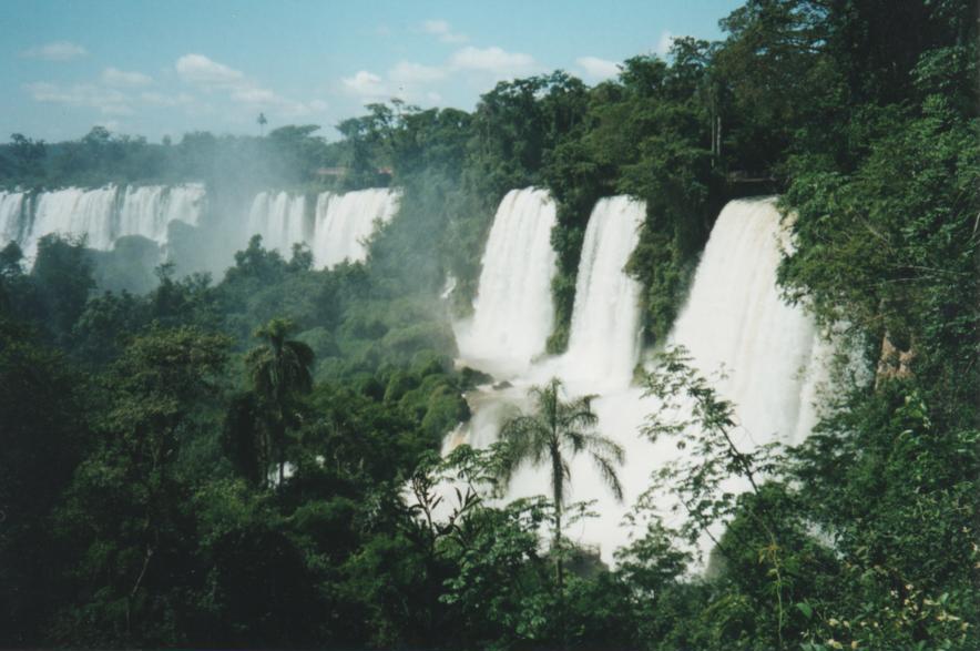
Now a view from the ground. In case you were wondering, this is what Misiones looks like from the ground (ok maybe these are the more touristy parts).


Quantumleap42 or anyone else,
ReplyDeleteDoes anyone know of any studies that show whether the atmosphere has been altered significantly by deforestation? I'm just curious.
I thought about looking for some but I didn't have time to look before I posted and went to bed.
ReplyDeleteOne thing I should point out is that the deforestation changes several things, such as the albedo of the land, it exposes soil and allows for accelerated erosion and decreases the CO2 converting biomass. If you look at the bottom of both pictures you can see a large tan colored area. That is El Rio de la Plata by Buenos Aires (also visible, as a gray splotch). The reason why the "river" is so brown is it is full of sediment being washed down the Rio Paraguay, which flows into the Rio Parana, and just above Buenos Aires the Parana and the Rio Uruguay flow together and dump all of their sediment there. For more reference, the Rio Parana marks the western border of Misiones, and the Rio Uruguay marks the eastern border. You can see the Parana as a thin green strip going up into Brazil. The northern border of Misiones is marked by the Rio Iguazu, which if you look at the hi-res images you can see flowing in Brazil. The Rio Iguazu is the river pictured in the waterfalls (Iguazu Falls) right before it flows into the Rio Parana at the Tres Fronteras (Three Borders) where Argentina, Paraguay and Brazil come together.